
Customer: St John
Project Summary: Geospatial Analysis
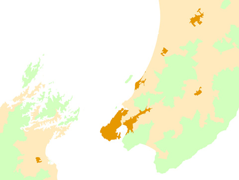
To accurately classify New Zealand into urban, rural and remote areas.
Challenge: To enable accurate reporting of KPI's for Ministry of Health Funding
Government funding for ambulance services is based on meeting specific performance criteria, for instance, that an ambulance has arrived at 90% of Priority 1 calls in a given urban area within a designated timeframe.
Surprisingly, the definition of what constitutes an urban, rural or remote area has never been addressed in New Zealand by government, academia or industry, even though this lack of specificity has been apparent for more than a decade. The problem was identified by Susan Crampton while completing her MBA at University of Canterbury, and wondered whether the classification should, and could, be generated spatially.
Vicinity Solutions' first task was to create a methodical and objective classification and reporting system to correct this imprecision in the data.
An additional challenge was to ensure that the urban, rural and remote area designations could be easily updated to reflect demographic changes over time and meet the ongoing requirements of both St John and the Ministry of Health.
"Vicinity Solutions have provided us with new insights on how we can extract business benefit from our data.
Thanks to the new dataset, not only do we have more confidence in the data and our reporting, but areas that were previously thought to be underperforming were, in fact, found to be working well."
Colin Lawrence
ICT Operations Manager, St John
Solution: Using census data to calculate an urban/rural/remote classification system
In deciding how to undertake this project, Bryan Clarke from Vicinity Solutions had an overriding ambition: to ensure that the classification process was calculated from a reputable dataset and that the process could be re-run when new data becomes available. As this was a fairly complex analysis it needed to be repeatable and automated.
As Bryan notes, "It's understandable that the client's business analyst might to want to classify certain towns as urban and others as rural for commercial or logistical reasons, but this type of subjective approach does not instil confidence in the result or meet Ministry requirements".
In order to produce a more objective and robust outcome, Vicinity Solutions arrived at an understanding with the client that any changes they wanted to make to the spatial rules would be applied uniformly across the country and would utilise census data as its primary data source.
"Using census data as a reliable external information source means that both St John and the Ministry can be assured that the resulting dataset is an objective and appropriate benchmark for assessing incident response times. The feedback from those involved so far has been very positive." comments Bryan.
Business Benefit: Better data, better decisions
St John can now be certain that they are reliably reporting on service levels, and that they are receiving accurate information about which areas are performing well and which require corrective action.
Shelley Sutcliffe of Vicinity Solutions reports, "Some areas moved from rural to urban and vice versa, but when calculated against the new dataset, information produced on countrywide trends and response times support the efficacy of the enhanced analysis, giving St John more confidence in their improved dataset".
Indeed, St John has found the new dataset so valuable that they are now using this information much more widely in decision-making than they had anticipated, enabling more effective management of the organisation on multiple levels.
Download this case study
St John Rurality case study (1MB PDF)