
Customer: Waimakariri District Council
Project Summary: Geospatial Information System Enhancement
To redesign the Waimakariri District Council GIS and data management systems to allow for data compatibility and ease of use.
Challenge: To identify and remedy the poor fit between local government data and a land parcel-based GIS
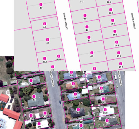
Like many Councils, Waimakariri District Council (WDC) has Local Government Information Systems (LGIS) data that is ownership-centric, but a GIS that uses land parcels. This inconsistency between data and GIS was minor enough for the WDC to 'make due' in normal circumstances, but the challenges posed by the 2010 Canterbury Earthquake stretched this discrepancy to the breaking point.
In a situation that required time-sensitive responses on an unprecedented scale, it became difficult for decision makers to tell whether a building had been searched or not, or, in cases where more than one building was on a land parcel, which building had been damaged.
Waimakariri District Council engaged Vicinity Solutions to review their existing data structures and recommend improvements to data and processes, yet 'keep it simple'. Vicinity Solutions also assisted with implementation and integration across several platforms.
"We should have done this years ago".
Sheryl Cowan
GIS Analyst
Solution: Automated data processing and integration
Vicinity Solutions worked with WDC to develop automatic spatial processing of rating parcels and address points that integrated with their LGIS data.
Shelley Sutcliffe from Vicinity Solutions ensured that the solution that was put in place optimised efficiency and accuracy, and minimised in-house data capture. She developed automated geospatial processes that handled address points for multiple flats on a parcel, and rating parcels spanning multiple land parcels. The integration spanned multiple GIS systems, due to a change of GIS platforms.
Shelley says "a key part of the success of the project was due to the creation of an improved spatial data repository". Vicinity Solutions also designed improved workflows to ensure speedy and cost-effective data cleansing, along with smart fixes which assisted with the translation of data for conversion to the improved GIS platform.
Business Benefit: Better and more reliable data with less effort
The WDC experienced first hand what happens when small inefficiencies that are manageable in normal circumstances become overwhelming during a major emergency - the very time when it's essential that data is reliable and easily accessible.
Thanks to the automation of processes implemented by Vicinity Solutions, the WDC are now able to have confidence in the accuracy of their data and their ability to respond to crisis situations.
Download this case study
Waimakariri District Council case study (854KB PDF)